![]()
![]()
![]()
![]()
![]()
|
|
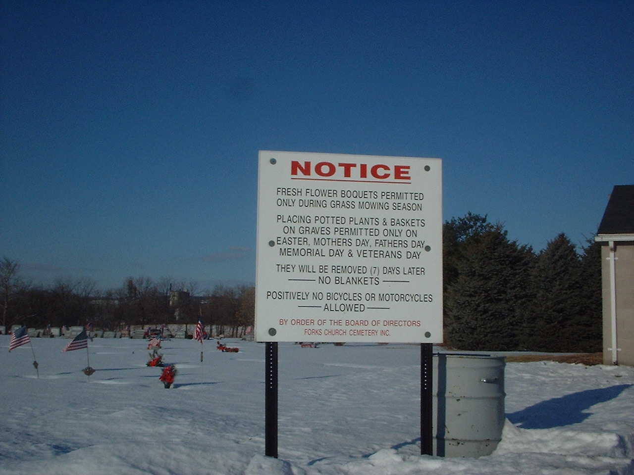
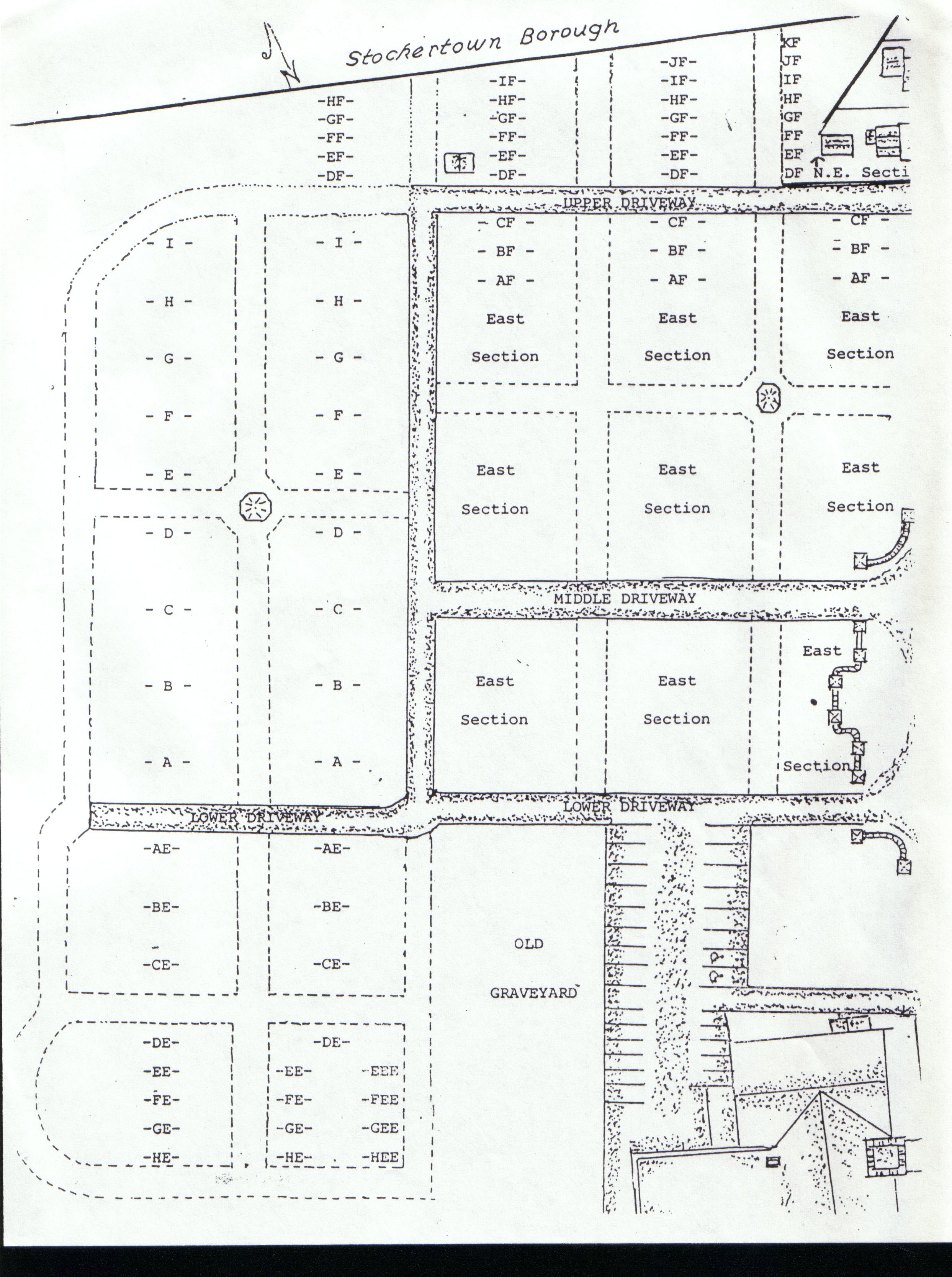
The Rules Board is located along the upper road on the front garage wall. Cemetery hours signs are located at the entrance to the lower and middle roads. While plot deeds also recite the cemetery rules, older deeds will not have the current rules. Please call or email questions if in doubt. It is our desire to keep the cemetery accessible during daylight hours. If illegal dumping on cemetery grounds, access for inappropriate meeting and/or flagrant use of the sacred grounds for recreational purposes or consumption of alcohol is found to occur, access will be limited to restricted hours only when a guard is on duty. The cemetery grounds are randomly monitored with cameras. Fireworks and fire arms are never permitted on cemetery property except for authorized military services. Benches may be placed at certain locations on the perimeter of the cemetery grounds. However, a request to place a bench must first be submitted to the Board of Directors for approval. Forks Cemetery permits tomb stones that rise above ground level and in a designated area, tombstones, plaques or markers that are flush with ground level. Please refrain from creating a shrine comprised of personal items in lieu of an approved tombstone or marker. Most cemeteries permit only permanent markers. If requests to remove personal items are ignored, cemetery workers will remove and save the items. During late Winter or early Spring, the cemetery will advertise in church bulletins and the Nazareth Key a date by which seasonal grave blankets or decorations should be removed if you wish to save them. This date typically falls 2 weeks prior to the earlier of Easter Sunday or the beginning of the mowing season. A new section, approximately 1 acre in size, is located to the southwest of the main cemetery. When entering on the lower road from Sullivan Trail, proceed to the end of the macadam road. You will note the "old grave yard" to your left. Continue southwest into the new section.
|